How surveillance cameras add value to digital twin cities?

Virtual worlds have been receiving a lot of attention recently, not least due to the focus on the potential new ‘metaverse’ we’ll all no doubt be encouraged to join. From a smart city perspective, creating models of the processes and journeys occurring across the urban environment can bring many benefits, helping city authorities more quickly achieve their objectives.
These models can aid in understanding the dynamics and rhythms of the city – both historically and in real time. Using this information, insights can be gathered on different factors, such as congestion rates, response times, air quality and traffic flow, and used to inform future planning decisions.
Creating virtual models may sound like sci-fi, but these activities are already in progress. City officials are starting to collate data from different departments into ‘digital twin’ platforms to help them understand and predict the impact of different scenarios. These may include reviewing the effects of planned roadworks on traffic flow, working out the best evacuation routes if an incident occurs or analysing the impact of measures to improve air quality or energy consumption. Network surveillance cameras play a key role by acting as critical sensors to capture visual data from around cities and record events in real time.
What is a Digital Twin?
Before discussing how digital twins are used, it’s useful to know what they are. Digital twins are virtual representations that serve as the real-time digital counterpart of a physical object or process. In a smart city context, these are virtual models of the city built using data collected also from IoT sensors. This data can vary widely and include factors such as air pollution levels, noise levels, meteorological conditions, and the movement of vehicles, bikes, and pedestrians through certain areas of the city.
Where the digital twin platform becomes very useful is when city officials attempt to understand movements, behaviors and the subsequent impact of different events.
For example, if a concert is taking place in the center of the city, data can be gathered to find out how people are accessing the event; which entrances tend to be most crowded and the direction of foot traffic. Using this information, city officials can extract learnings and make assumptions about the behavior of crowds at future events in the same venue. This can also inform incident response planning, as information about the least crowded entrances can be used to predict emergency response routes.
Understanding the dynamic rhythm of the city
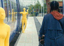
The information isn’t limited to a single event. By extrapolating the monitoring capabilities, the general movement of traffic around the city can be traced and mapped. This includes information about the number and type of vehicles and how citizens use the roadways over a period of time.
For future city planning, this information is invaluable, as it can be used to inform decisions about changes to urban infrastructure. For example, if a road is to be pedestrianized, then the effects on road and foot traffic can be visualized using a model before the improvements are implemented.
As data is collected from multiple sources into the digital twin platform, advanced analytics such as multidimensional AI can be enabled. This is where AI is applied to analyze different data sets to draw greater insights that can be applied at a macro level.
These learnings can be used when going through ‘what-if’ scenarios, as the impact and outcome of an action can be reviewed. In this way, challenges can be anticipated and planned for intelligently.
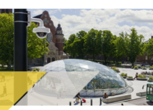
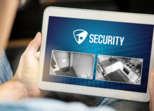
Surveillance cameras provide valuable input
The strength of digital twin platforms depends on the quality and the granularity of data input from sensors positioned strategically around the city. These will feed information into the models so that the virtual representations can be accurately built. Network cameras are critical to this process as they not only provide surveillance – capturing high-quality images which are the foundation for valuable analytics insights – but also real-time visual feedback to help inform subsequent actions.
Applications at the edge can analyze video captured by image sensors, to provide information related to crowds (such as people counting) or the classification of vehicles in an area. This information can then be funneled into the digital twin platform.
This is particularly useful when trying to determine what action would cause the least disruption to the natural dynamics of the city. For example, if officials had to close a road to carry out maintenance work, they can use the model to first understand when the road was the least busy – and hence what time would be best to carry out the works to minimize congestion. Once this is known, maintenance staff can be scheduled and dispatched to the site to close the road.
Cameras add even more value as they can be used to capture the resulting impact of the road work in real-time, for example, whether congestion increases significantly as a result of the closure. If this is the case, officials can then be deployed to manage traffic and re-route vehicles to ease congestion. This information would not only be useful at the time but can also be kept on file and used for reference when it comes to planning future similar scenarios.
Supporting smart city goals – now and in future
Smart city goals can be varied and range from reducing response times, to decreasing crime rates, and improving the availability of parking. Data collected in smart cities is used to support these different goals, not only to improve liveability for residents but contribute to wider sustainability objectives.
Digital twin platforms can help city officials collect information, take specific actions, measure progress and predict outcomes. For example, if improving air quality is an objective, city officials can review the digital twin model to see where and why congestion occurs and make specific plans to proactively address the cause. This could include opening more lanes or adjusting traffic light timing at certain times of day to improve vehicular flow. One thing that must be borne in mind is the security of the platform, to ensure the insights are trustworthy and have not been tampered with.
Network surveillance cameras will play an important role, by providing visual data to help monitor activity in real-time and inform planning for future events or changes. The verification of events also helps to build digital trust in the technology, leading to increased adoption. Ultimately, these types of virtual models will become a critical factor in moving smart cities closer to their objectives and reaping the associated benefits for residents and visitors alike.
Click here to find out more about Axis’ solutions for smart cities.